
BLIDA GEOGRAPHY
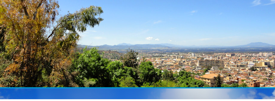
Blida is a city in Algeria, North Africa. It is one of the 48 wilayas (provinces) situated in the north of Algeria. It lays attractively beneath the mountain of Chrea which is part of the Tell Atlas Mountains and on the right bank of Oued (river) Sidi el Kebir. It is 48 Km southwest of the Algerian capital Algiers.
BLIDA BLOOMING IN SPRING : Beneath Chrea mountain and not far from the seaside of the Mediterranean Sea
Located at around 182.8m above the Mediterranean Sea, it lies on the southern edge of the Atlas Mountains, beneath the mountain of Chrea. The ‘Tell Atlas’ mountains is a set of connected mountains in North of Africa stretching over 1500 km from Morocco through Algeria to Tunisia. The Mediterranean Sea is situated opposite the Tell Atlas Mountains.
Blida is 22.5 km from the nearest Mediterranean seaside. The vast Atlas Mountains shield the town from the dry southern winds of the Highlands of Algeria. Blida and its neighbouring villages and towns have the benefit of the Mediterranean climate which is suitable for agriculture throughout the year. Blida is situated at the heart of the vast fertile Mitidja plain.
Climate
Like most northern cities in Algeria, Blida enjoys the typical Mediterranean climate with mild and gentle springs, warm and dry summers and rainy winters with snow in towns and on the Mountains of Chrea.
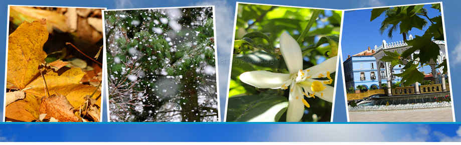
FOUR SEASONS CLIMATE: Each season in Blida brings its colourful scenery
The crossroads
Blida sits geographically among Algiers and Tipasa in the north, Bouira and Boumerdes in the east, Ain Defla in the west, and Medea, the Atlas mountain of Chrea and ‘les Gorges de Chiffa’ to its south.
Click (+/-) on the right bottom side of the map to explore the location of Blida. MAP COURTESY OF GOOGLE
The Province structure
The Wilaya (Province) of Blida has 10 dairas (districts) and 25 communes (towns). The 10 dairas (districts) are: Blida, Boufarik, Bougara, Bouinan, El Affroun, Larbaa, Meftah, Mouzaia, Ouled El Alleug, Ouled Yaich. The 25 communes (towns) are: Ain Romana, Ben Khellil, Beni Mered, Beni Tamou, Blida, Bouarfa, Boufarik, Bougara, Bouinan, Chebli, Chiffa, Chréa, Djebara, El Affroun, Guerrouaou, Hammam Melouane, Larbaa, Meftah, Mouzaia, Oued Djer, Ouled El Alleug, Ouled Sellama, Ouled Yaich, Souhane, Soumaa.
Population
The wilaya (province) of Blida has over a million inhabitants and covers an area of 1,479 km2. Daira (district) of Blida consists of two ‘communes’ (towns), Blida and Bouarfa. It has a population of over 213.759 within an area of 72.1 km2. A population of 174.499 live in the town of Blida (Chef lieu de la wilaya) and 39.260 in Bouarfa *.
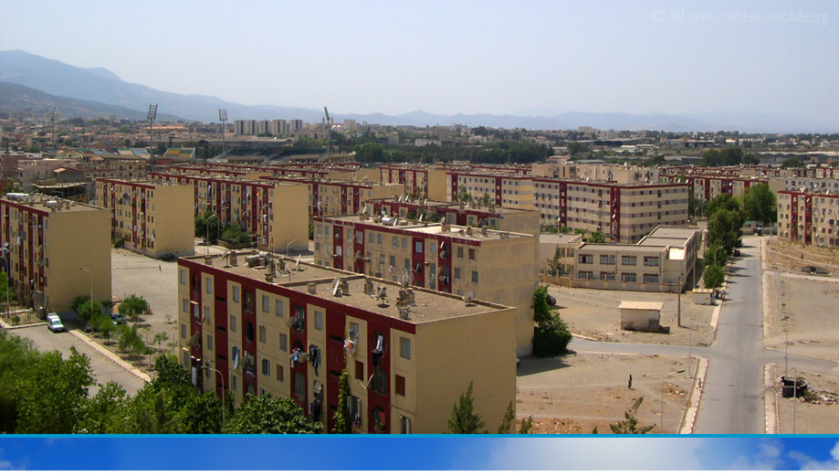
POPULATION GROWTH: Cite 1 Mai known as 'les 1000 logements' was one of the first council built estates of flats after independence
Daira (district) of Ouled Yaich south east of Blida consists of three ‘communes’ (towns); Ouled Yaich, Beni Mered and Chrea with a population of 155.358 inhabitants (Ouled Yaich 109.621, Beni Mered 44.703 and Chrea 1.034).
Daira of Ouled El Alleug, Beni Tamou and Ben Khelil have a population of 126.492 (Ouled El Alleug 44.725, Beni Tamou 47.970 and Ben Khelil 33.797).
Daira of Boufarik has a population of 139.909. It consists of three ‘communes (towns) Boufarik (78.112 habitants), Soumaa (40.956 habitants) and Guerouaou (20.841 habitants)*.
Aggriculture and Business hub
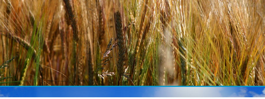
FERTILE MITIDJA: Blida and its surrounding areas produce large quantities of vegetation and crops
Blida and the fertile soils of the Mitidja plain have always been known for its agriculture and trading of wheat, barley, fruits, vegetables and olives. It was known as ‘Le potager de l’Algerie’. Unfortunately in the last four decades, many of the fertile lands in the region of Blida have been taken over by urbanisation. Blida also has the reputation of being a commerce hub that attracts a lot of business from different parts of Algeria.

* Source: Wilaya de Blida (Blida City Council)


